Assessing the California Storms
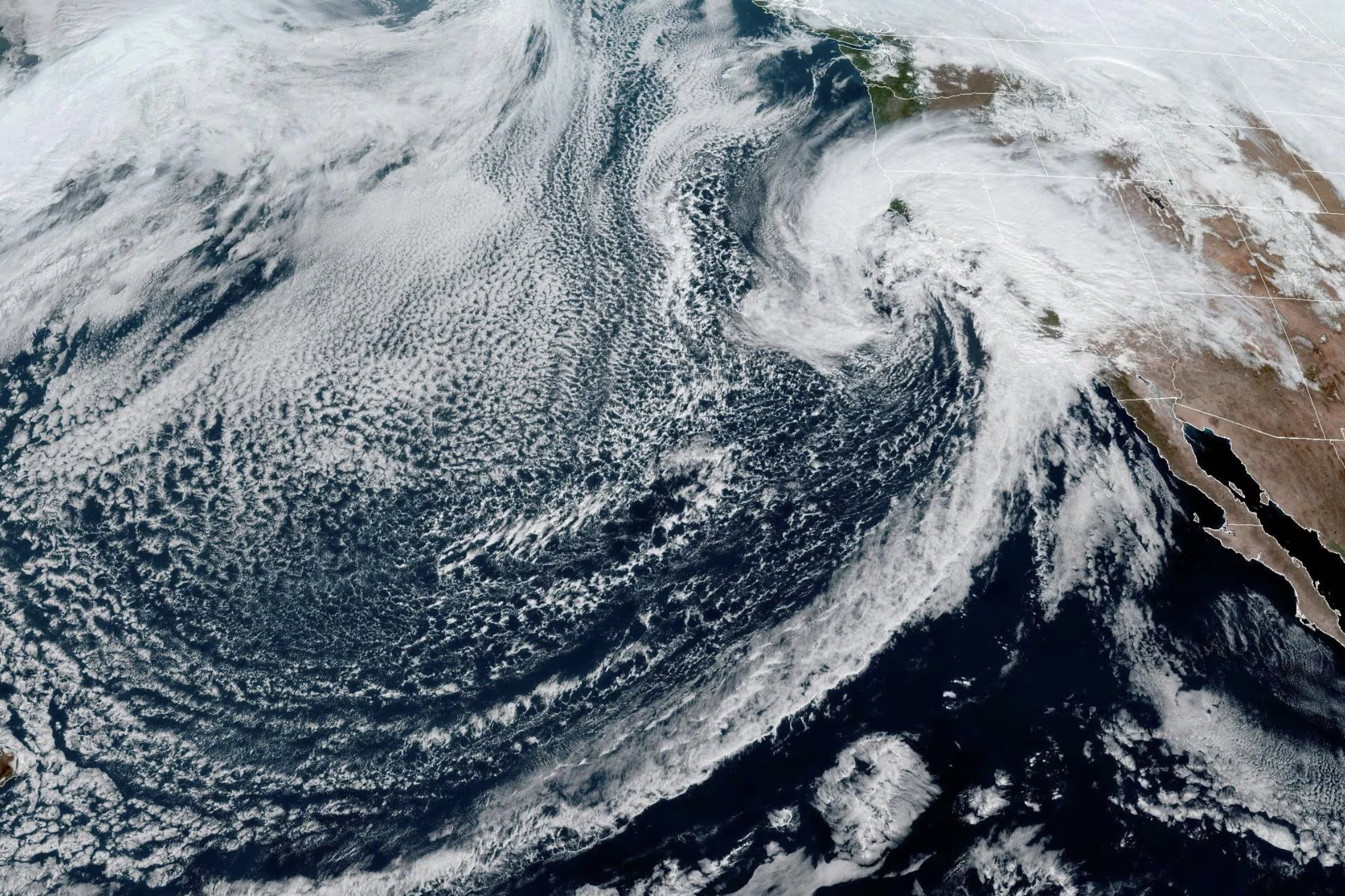
Atmospheric River over California. Image courtesy of NOAA
As Californians begin to dry out after a week of near-constant rain, residents are assessing damage from the recent storms. Meanwhile, scientists are evaluating the storm itself and reflecting on how it fits into the larger landscape of weather events.
Parts of California received 10 to 15 inches of rainfall in a day — the amount they might usually get in a season. Many areas experienced mudslides, landslides, flooding, power outages, and other issues.
“It’s not uncommon to see increased precipitation during the winter in California,” said Zachary Handlos, senior academic professional in the School of Earth and Atmospheric Sciences. “The problem is when it’s too much at once, which is exactly what happened.”
An atmospheric river, as it is called, is a weather phenomenon that transports water moisture from the ocean toward land areas following relatively narrow paths. As Annalisa Bracco said, most of these are harmless and useful. In an El Niño year, though, the ocean is warmer than usual, and more moisture is carried in the atmosphere.
“Is this event exceptional? Yes and no. It is not the strongest recorded, but it’s up there among the very strong,” said Bracco, professor and associate chair for research in the School of Earth and Atmospheric Sciences. “The problem is that global warming is poised to make strong atmospheric rivers more common. Warming tends also to make the atmosphere more stable, which implies that weather systems evolve more slowly. And this atmospheric river indeed moved slowly, causing more damage.”
Though California’s geography is somewhat unusual in having atmospheric rivers, other areas experience them as well. Handlos noted that, though the terminology is not used as often, a similar effect can take place with southwesterly winds from the Gulf of Mexico toward the Atlanta area when impacted by weather systems.
Both Bracco and Handlos cautioned against attributing a single event to climate change too quickly but said that the California storm has all the markings of one that was more intense because of warming. “It is in line with all global warming predictions: more extreme weather events, conducive to both floods and droughts."
As recovery efforts begin, Handlos noted that this storm was very much in line with forecasts. But even with preparations, damage can be severe.
“The good news is that it wasn't some sort of day-before surprise, but even with excellent forecasting, you can only do so much to prepare for landslides and flooding,” he said. “There are still going to be unfortunate consequences for people in the area, even with preparations.”
He expects climatologists will look at the data from this event soon, and for several years to come.