Why Georgia’s Severe Weather Season Has Been Unusually Quiet
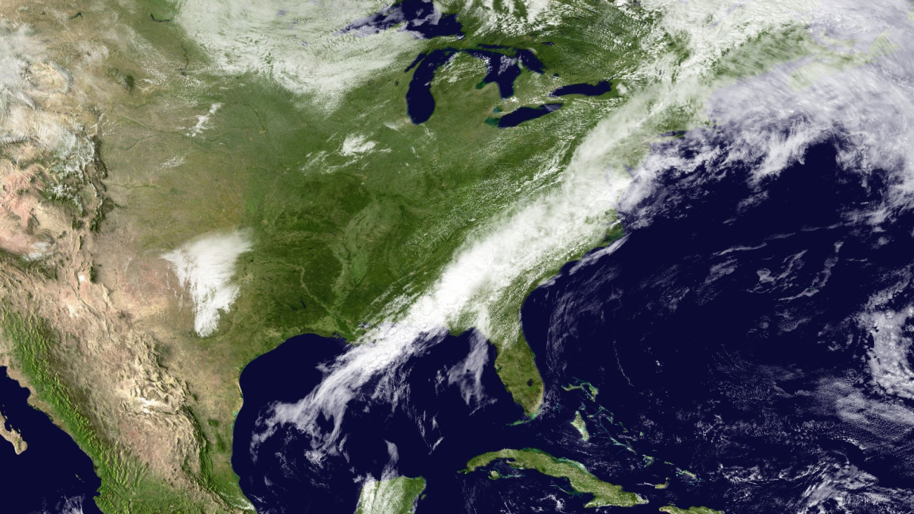
A 2010 storm system moving eastward, which brought severe weather to the Atlanta region. Image credit: NOAA NESDIS Environmental Visualization Laboratory; NOAA GOES-13 Satellite
The peak of the severe weather season is nearing its end, but in Georgia, it's been a quieter period than residents have become accustomed to in years past, devoid of the flurry of tornado warnings, heavy rain bands, and thunderstorms. Zachary Handlos, director of the B.S. in Atmospheric and Oceanic Sciences degree program, explains that the region lacked a major component of the severe weather formula.
For an active season, four key ingredients typically exist:
1. Moisture
2. A mechanism to lift air upward
3. Instability
4. Wind Shear
Despite drought conditions persisting throughout the state, there is sufficient moisture in the air, carried by warm air from the Gulf of Mexico and the Atlantic Ocean, to create favorable conditions for severe weather. Instability is created as the air warms, and wind shear is created by the changing direction and speed of the wind.
According to Handlos, what was missing this season was a consistent lifting mechanism.

"We've been stuck with high-pressure systems for most of the season. The air in these systems spirals clockwise instead of counterclockwise and spins away from the center, causing the air above it to sink, which in turn suppresses or shuts off any cloud or precipitation formation. So, even if all the other factors aligned, there would've been nothing to lift that air into creating those storms," he said.
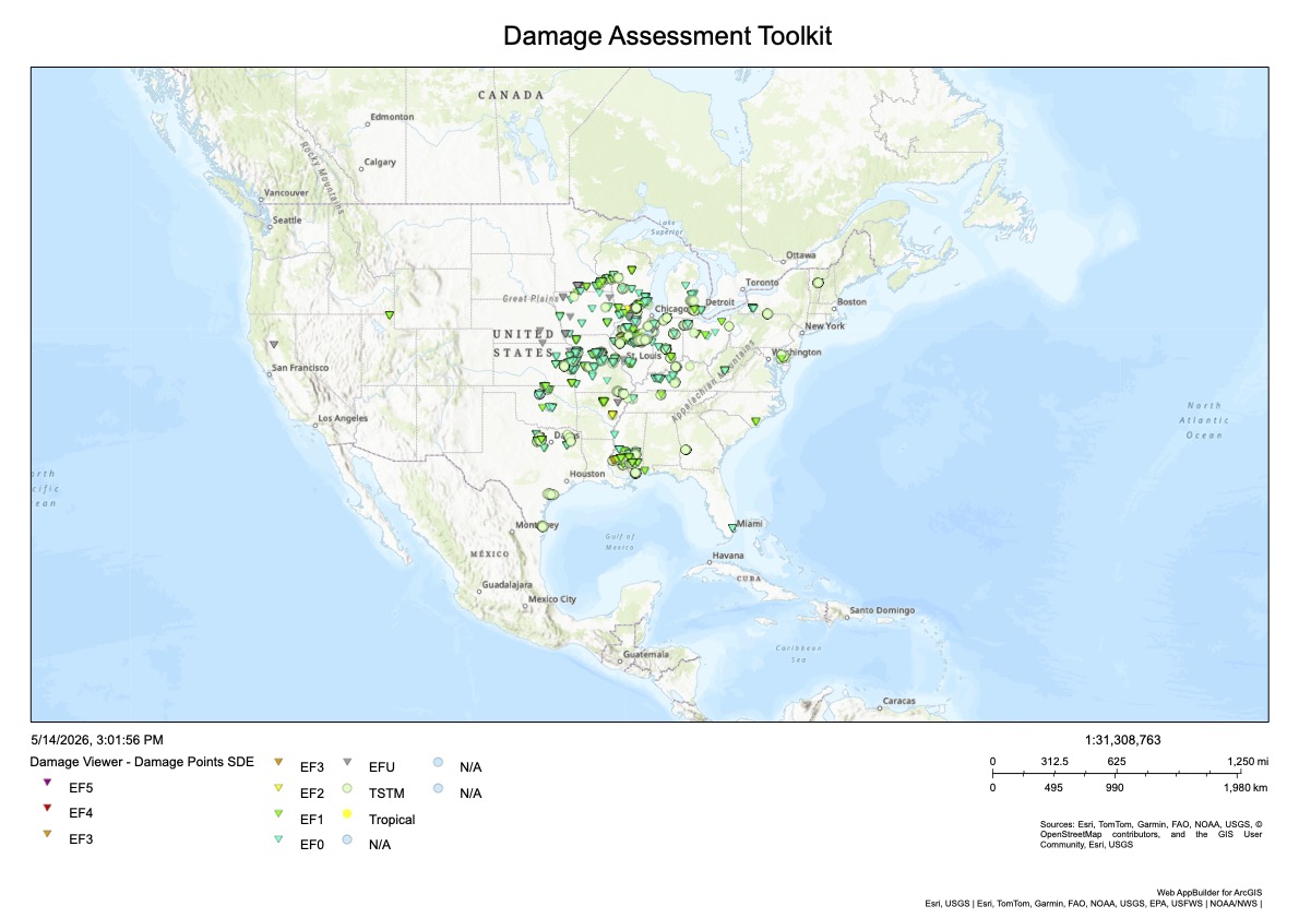
The lingering high-pressure systems over Georgia are the result of the state’s location relative to the jet stream, which Handlos describes as an interstate highway for storms. The jet stream is a fast current of air above the Earth's surface that brings storm activity with its movement. This season, the stream moved through the Midwest, resulting in record precipitation in the region, while a drought rages on in the Southeast. As of May 4, Illinois had confirmed 119 tornadoes in 2026, which began with a historically busy early season.
"If you didn't pay attention to any other part of the country (outside of Mississippi recently), you'd think it was the most boring severe weather season because there was very little activity in Georgia.But if you live along that jet stream line between Oklahoma, Kansas, Missouri, and Illinois, and southern Minnesota, Wisconsin, and southern Michigan, that has been the active area of severe weather."
While it has been a uniquely quiet season in Georgia, Handlos says that as it ends, the region can expect a typical summer.
"No matter if it's an El Niño or La Niña or neither, the quintessential Atlanta summer is one where, most days, you wake up, and it's warm and humid out in the morning with clear skies. Then, it's hot and just awful in the afternoon before you start to see the puffy cumulonimbus clouds pop up, and sometimes you get hit with a thunderstorm. For what feels like about three straight months, if you live here, you don't even need to look at the weather forecast to know what the weather will be like outside here until we get to the fall,” he said.
A quiet spring season could be a precursor to a brewing “super El Niño” at summer's end, experts predict. The potential pattern could cause a drastic rise in sea temperatures in the Pacific Ocean, and the disruption of weather systems could increase the likelihood of precipitation and severe weather in the Southeast. The increased precipitation could be a welcome sight for the region, lessening drought concerns and reducing the likelihood of wildfires.